The Evolution of Silence, launched 2013/ last update 2023
project
The Evolution of Silence
The Evolution of Silence is a multimedia research project by Rachele Riley, examining the visual representation of contested landscape and the impact of nuclear testing at Yucca Flat of the Nevada Test Site.
web-based map (HTML, CSS, jQuery), interactive and data-driven graphics, animation, sound, archival and original imagery, writing, typography,
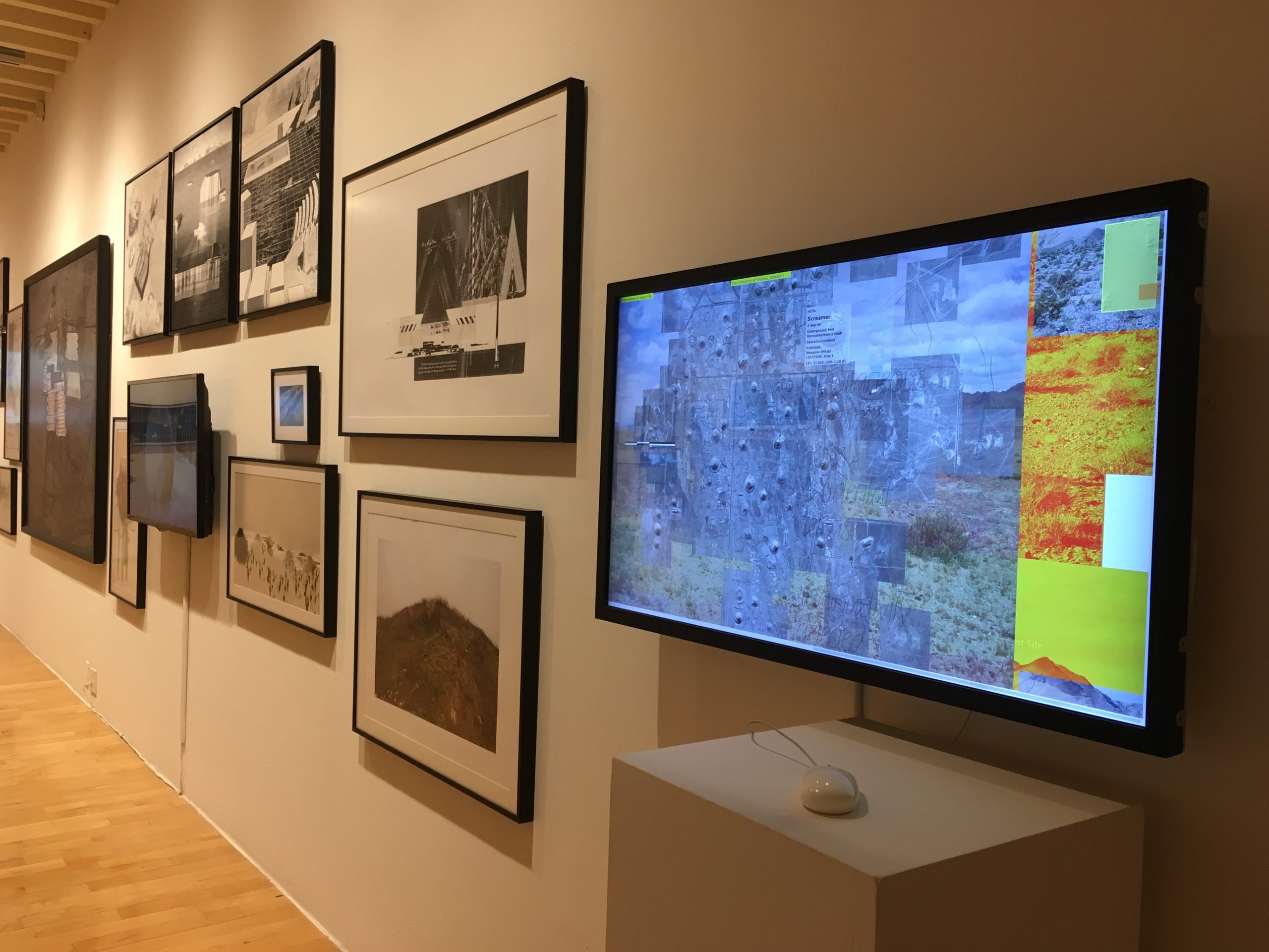
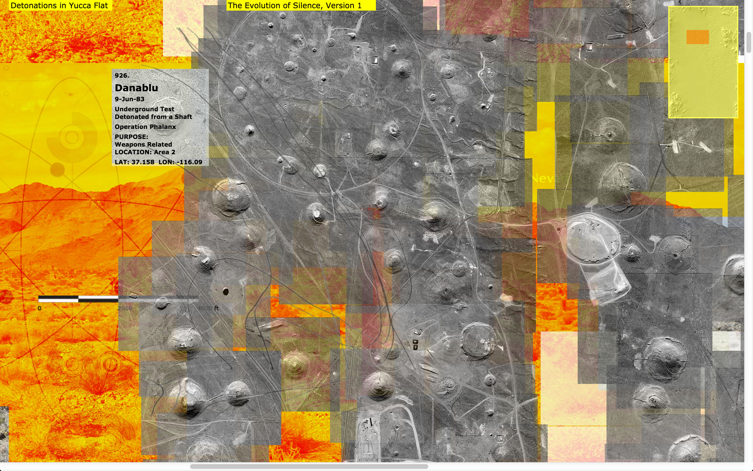
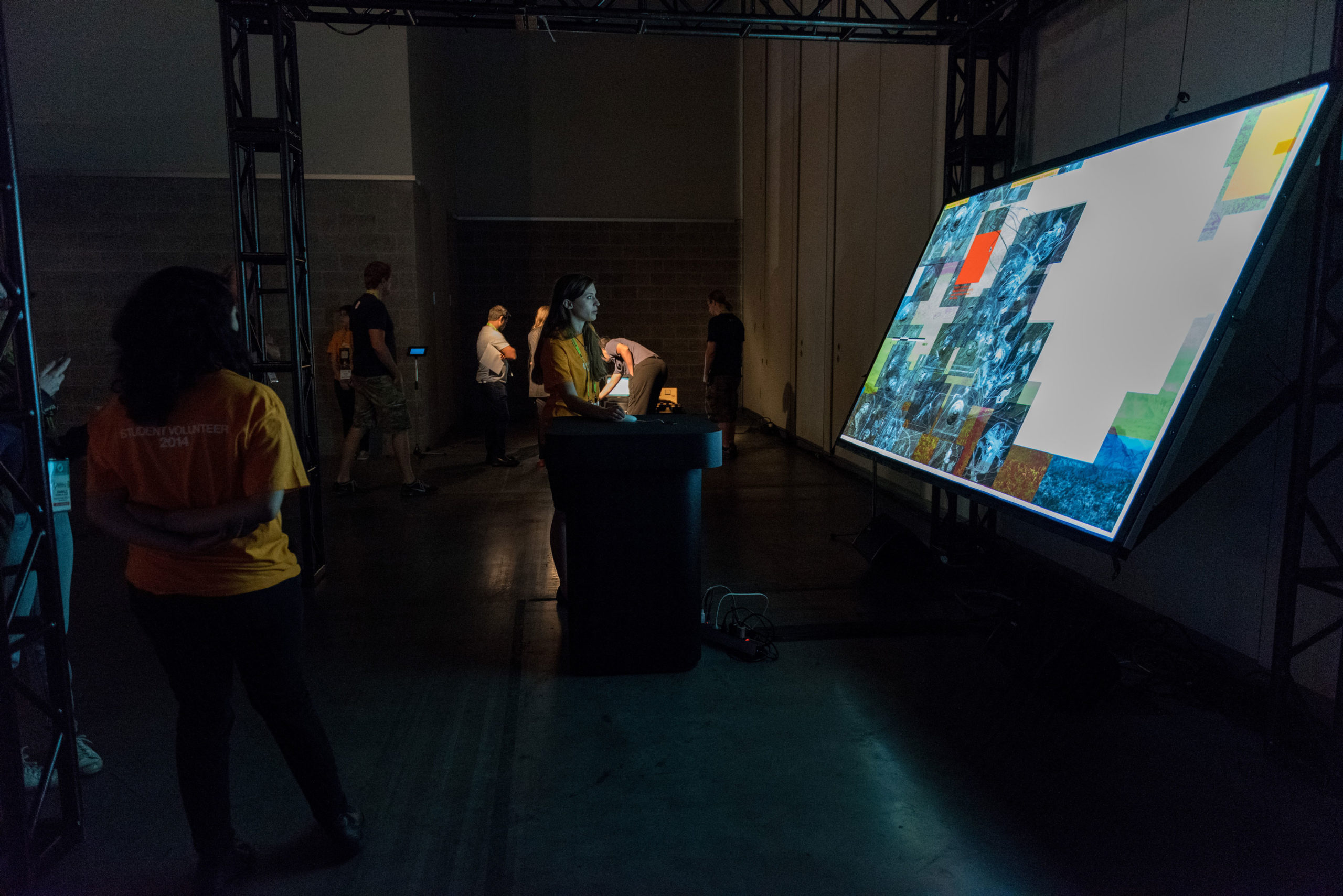
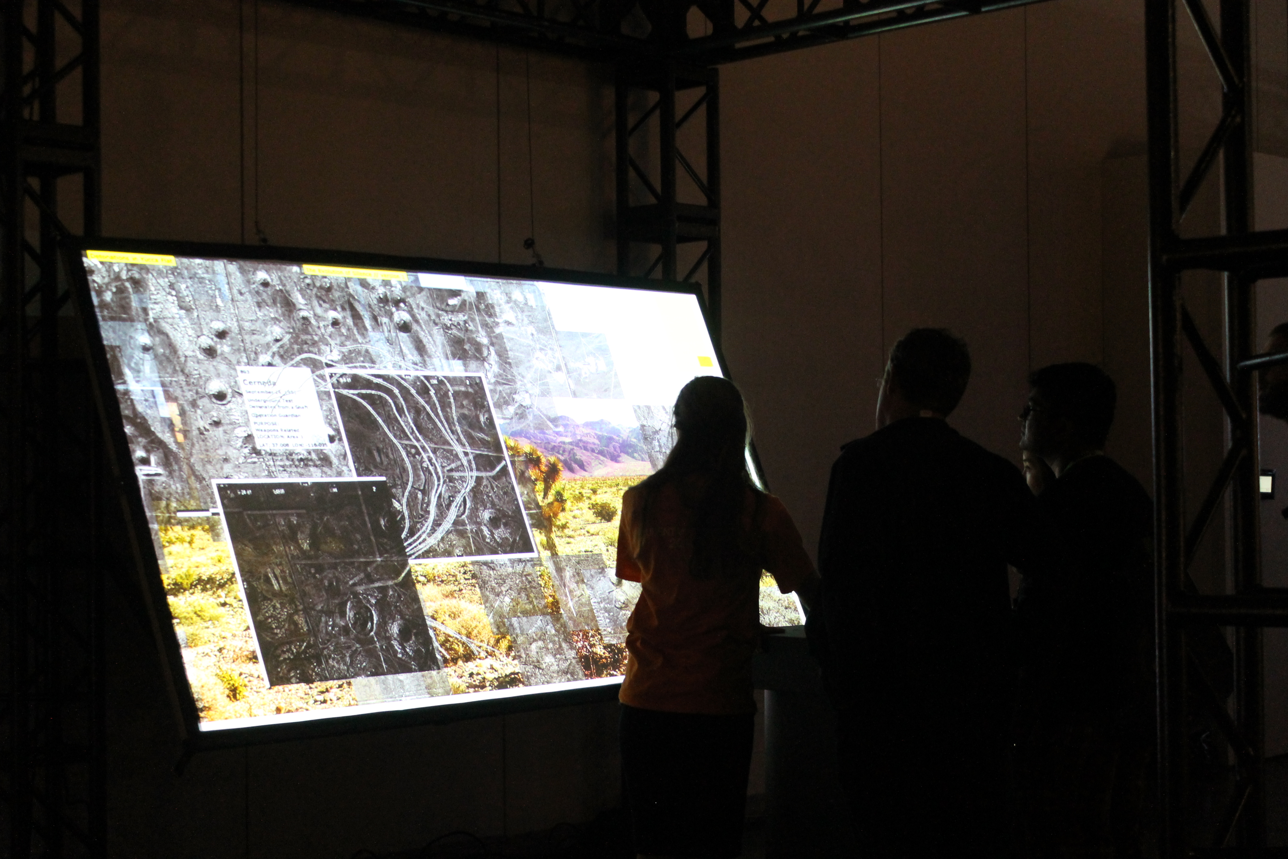
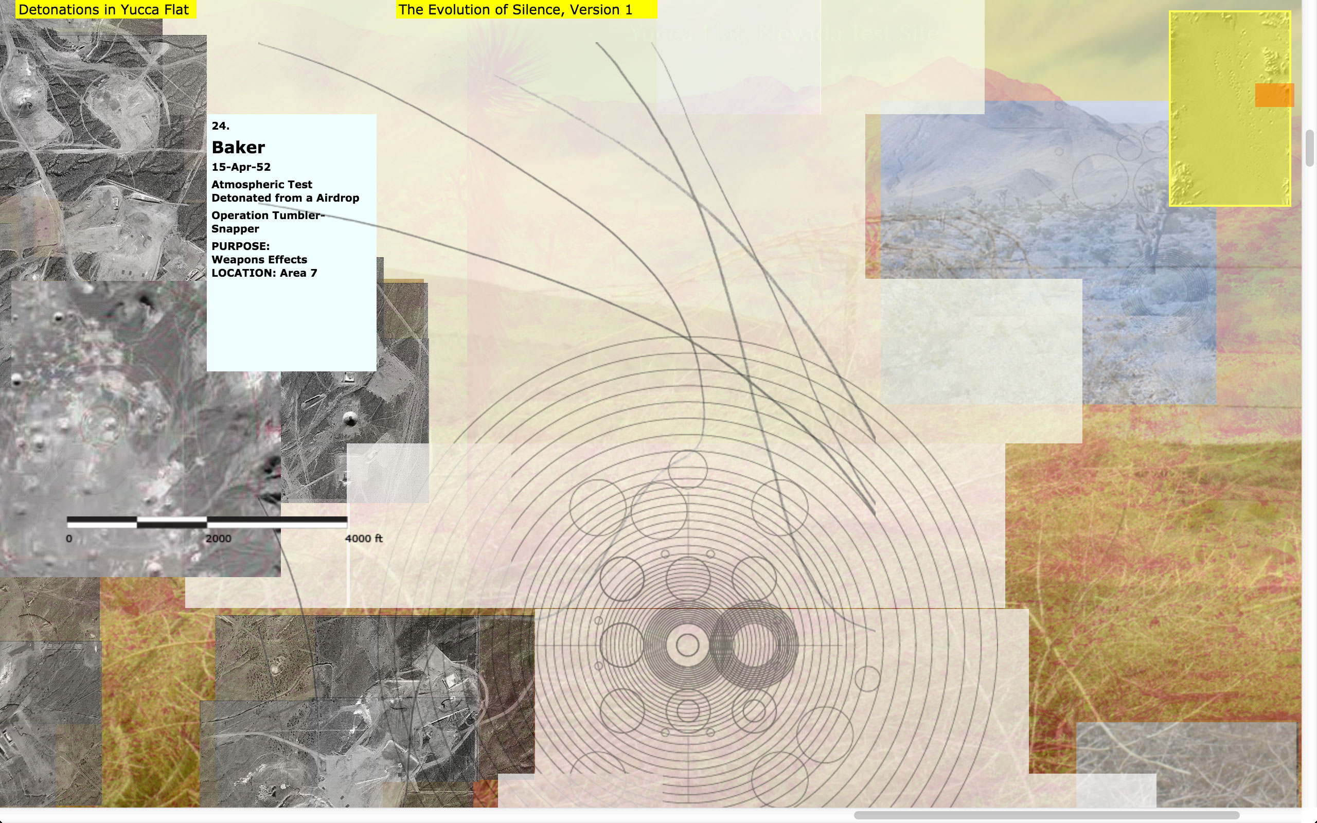
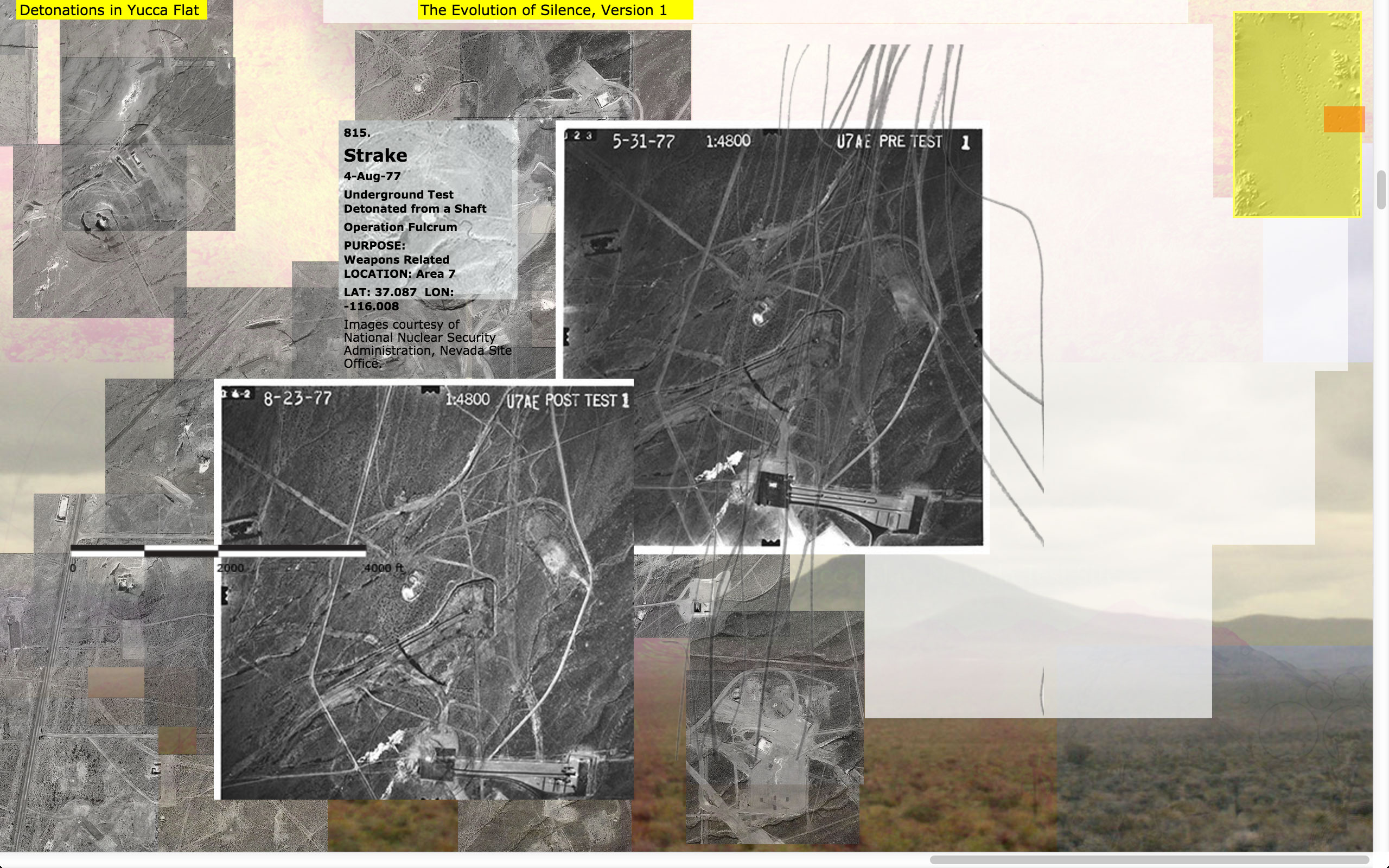
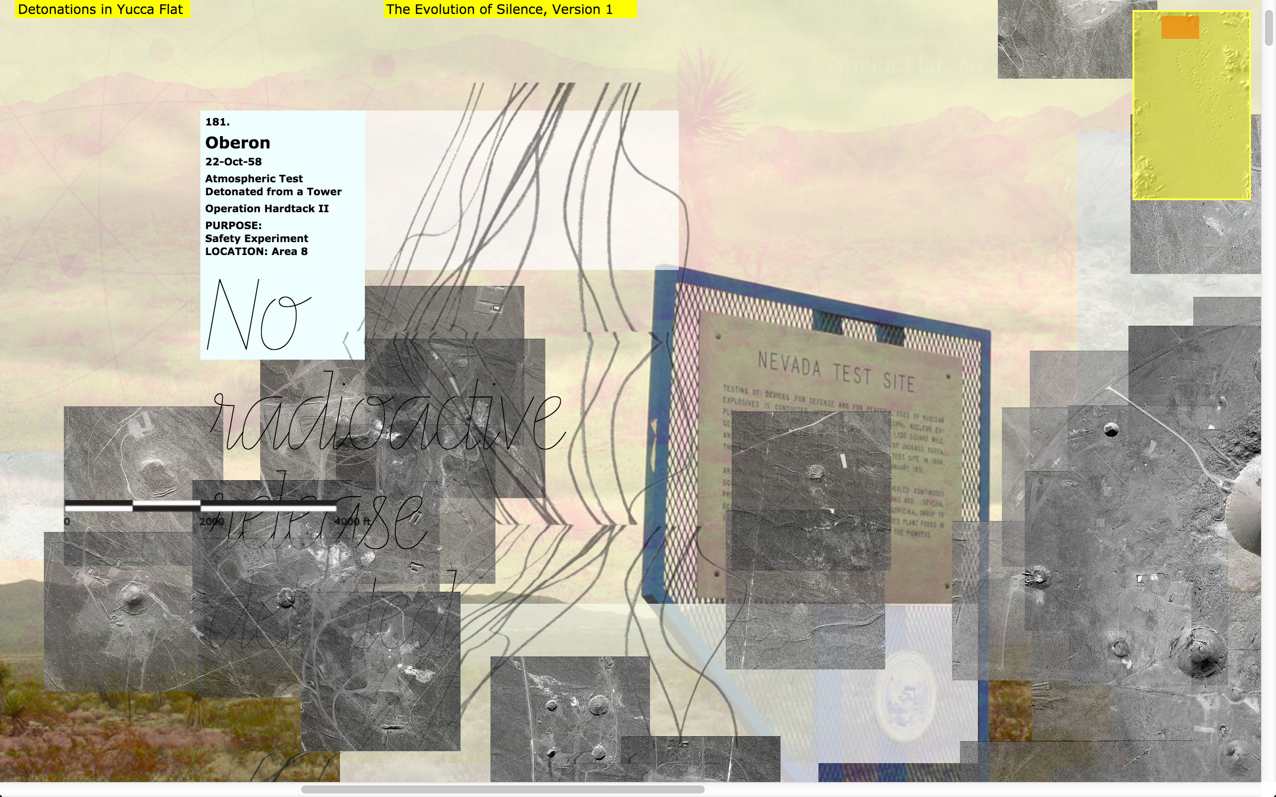
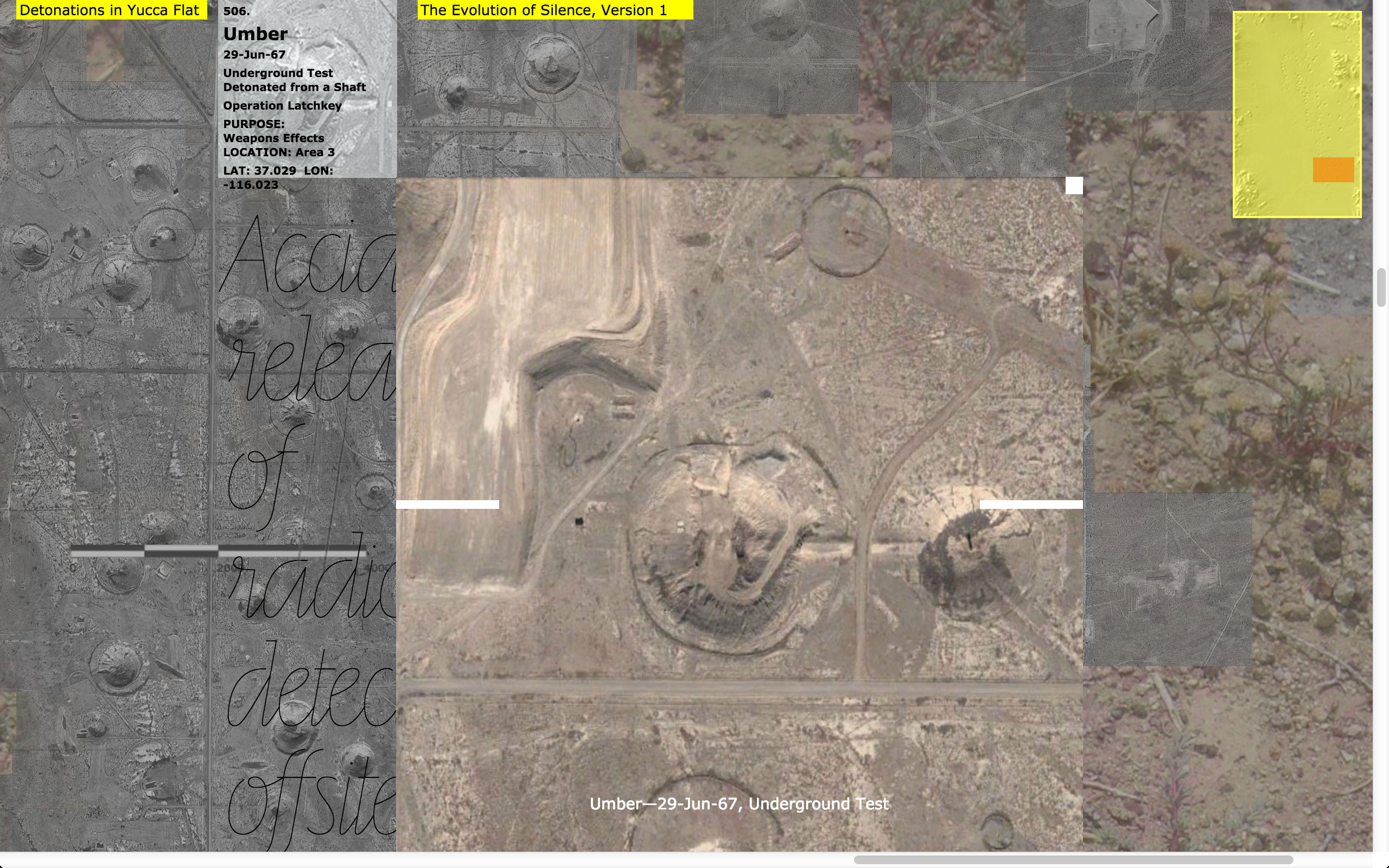
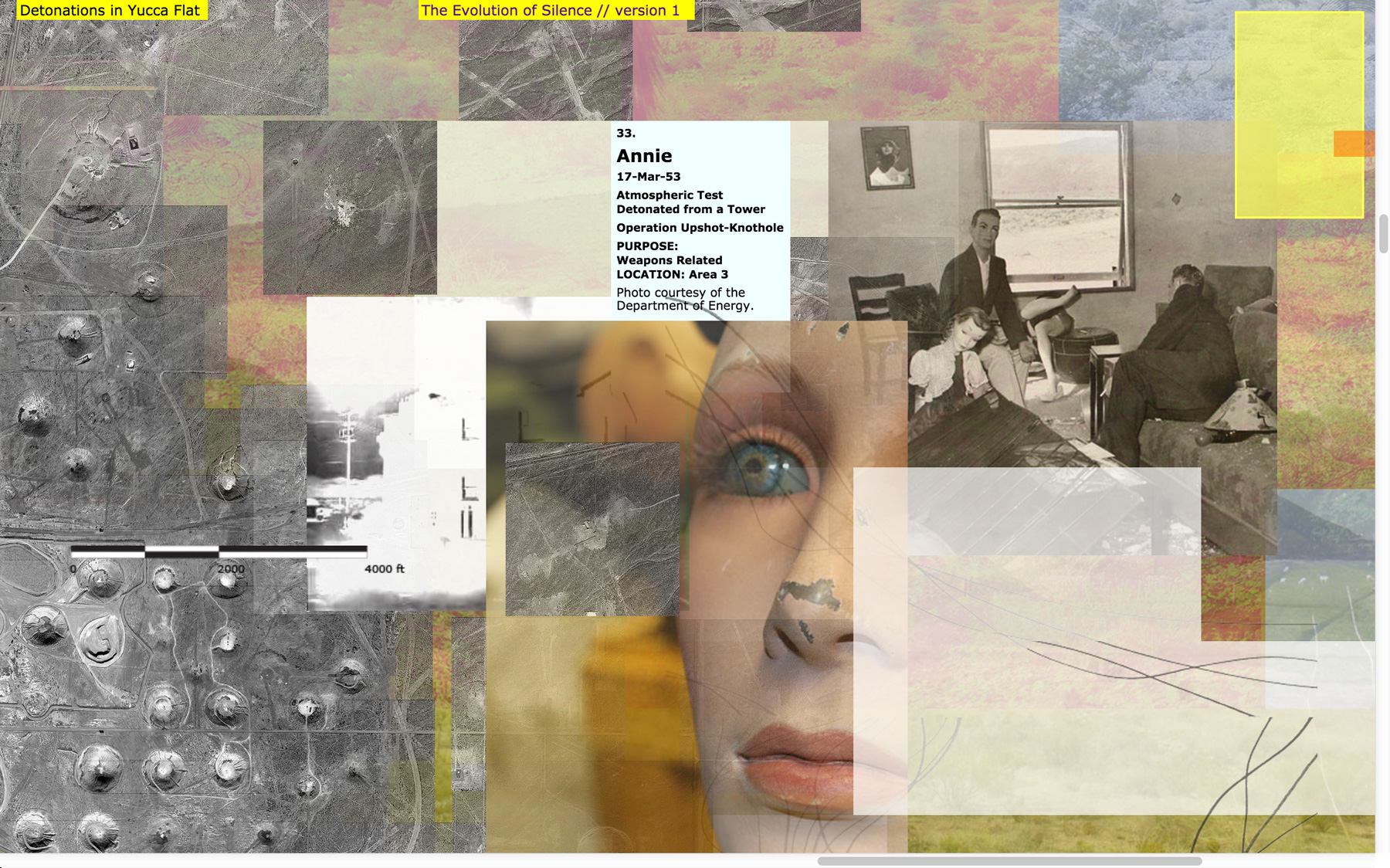
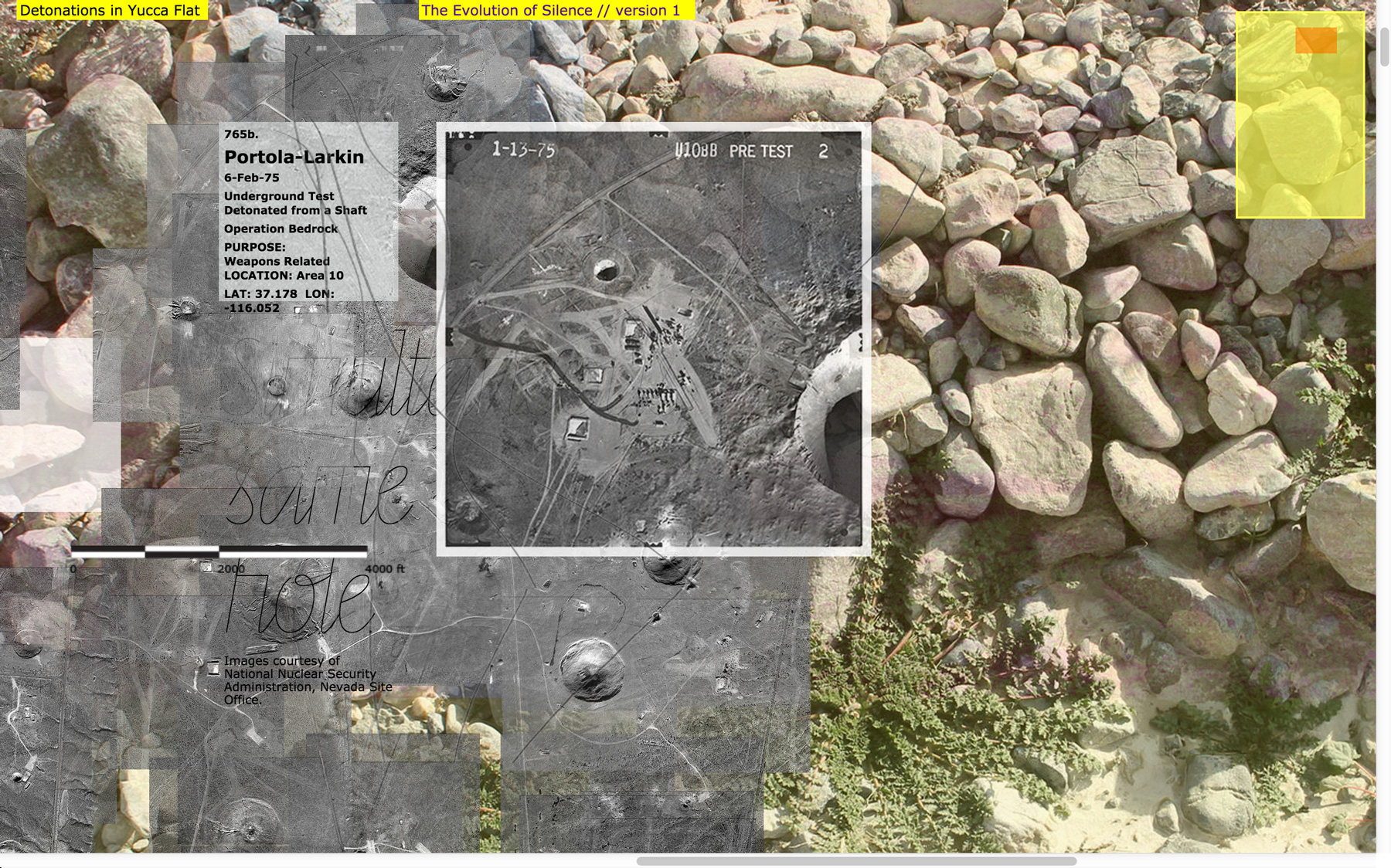
The Evolution of Silence, Version 1 (V1) is a web-based map, which explores the impact of forty-one years of post-WWII nuclear testing at the Nevada Test Site (a remote and highly-restricted area 80 miles north of Las Vegas, NV). The map focuses on Yucca Flat, an area within the Nevada Test Site, which is marked by hundreds of sinkhole craters caused by underground nuclear explosions.
As part of a series of explorations, the map presents a multivalent interpretation of the data of war and the dynamics of transformation. Layers to the project reveal disorienting views of the environment and of human involvement. The map visualizes the individual and accumulated location(s) of every nuclear detonation that occurred in Yucca Flat (828 total). The official data from the U.S. Department of Energy is connected to other kinds of data—my drawings, photos, videos, sounds, writings, etc. Fragments of satellite images (a grant from the DigitalGlobe Foundation) form a partially reconstructed aerial view of the valley floor, in which only the detonation sites are visualized. The viewer is able to break apart this composite image even further—by manually dragging the image tiles and actively rearranging and separating them from one another on screen. One is challenged through their own inquiry to make sense of the scale of violence that occurred and to conceptually reclaim this contested space through an experience of knowing. Bypassing government restrictions on the Nevada Test Site that limit its visual representation, the project allows anyone to engage aspects of this resilient landscape and to reflect on the toll of war.
→ www.evolution-of-silence.net/
→ blog.racheleriley.com/
credits
Copyright © Rachele Riley, 2013/2025 (art, design, research, concept, project director). All rights reserved.
Special thanks to Danniel Gaidula (technical consultant).
→ Published in exhibition catalog for Ambiguous Territory book, Actar Publishers, New York, NY & Barcelona, Spain, 2022
→ Exhibition at Handwerker Gallery at Ithaca College, Ambiguous Territory (traveling), Ithaca, NY, 2019-20
→ Exhibition at Pratt Manhattan Gallery, Ambiguous Territory (traveling), New York, NY, 2018–19
→ Exhibition at University of Virginia, Ambiguous Territory (traveling), Charlottesville, VA, 2018
→ Published in The Architect’s Newspaper, review of Ambiguous Territory exhibition, 2017
→ Award Recipient from the AIGA Philadelphia Design Awards, 2017
→ Exhibition at Taubman Gallery at Univ. of Michigan, Ambiguous Territory: Architecture, Landscape, and the Postnatural, Ann Arbor, MI, 2016
→ Exhibition at SIGGRAPH, Data Materialities, Vancouver, Canada, 2016
→ Exhibition at Weeks Gallery, Artifact and Process: The Evolving Field of Graphic Design, Jamestown, NY, 2016
→ Presentation at Mapping Ephemeralities, Rio de Janeiro, Brazil, 2015
→ Published in Studies in Material Thinking, Special Issue: Visual/Textual, Vol.13, Auckland, New Zealand, 2015
→ Discussion on EuDesignRadio, Milan, Italy, May 6, 2015
→ Award Recipient from the The Webby Awards (Official Honoree in NetArt), 2014
→ Published in Leonardo Journal Vol. 47, Issue 4, Special SIGGRAPH Issue, 2014
→ Presentation at SIGGRAPH 2014 Art Gallery Talks, Vancouver, Canada, 2014
→ Exhibition at SIGGRAPH, Art in Translation, Vancouver, Canada, 2014
→ Presentation and exhibition at Praxis and Poetics: Research Through Design, Baltic Centre for Contemporary Art, Newcastle-upon-Tyne/Gateshead, UK, 2013
→ Imagery Grant Recipient from the Digital Globe Foundation, 2012
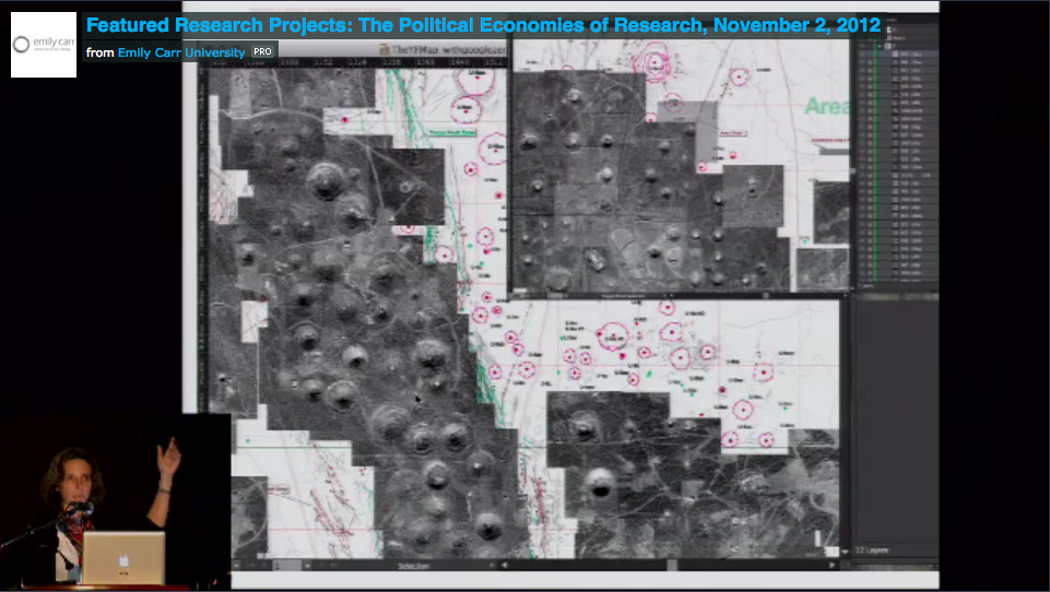
→ Presentation at AICAD Symposium Remaking Research/The Political Economies of Art and Design Research Panel, Vancouver, Canada, 2012
-
- The Evolution of Silence (launched 2013)
-
- Exhibition at SIGGRAPH, 2014
-
- Exhibition at SIGGRAPH, 2014
-
- (detail) The Evolution of Silence
-
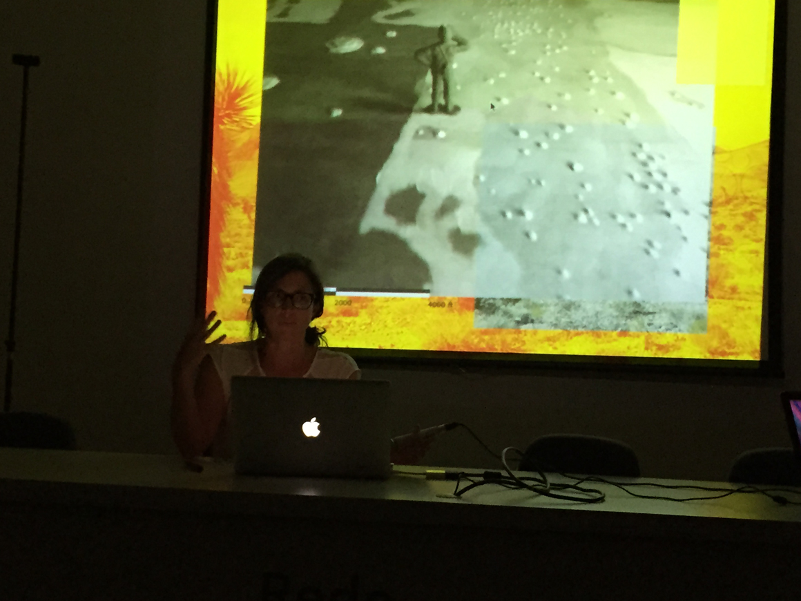
- Presenting The Evolution of Silence at Mapping Ephemeralities in Rio de Janeiro, 2015
-
- Launch at Praxis and Poetics in UK
-
- Presenting at AICAD Symposium
Thank you to a number of organizations for your funding support over the years: the University of North Carolina Charlotte, the University of the Arts in Philadelphia, the DigitalGlobe Foundation, the University of Illinois Urbana-Champaign, and the University of North Carolina Greensboro.
Special thanks to my friends and family who made individual contributions via Hatchfund to directly support this project at its initial launch phase in 2013: Richard Felton, Lisa M. C. Joven, Jerome Cloud, Hans-Ulrich Allemann, Erin Riley, Nonie Kimpitak, Paul Riley, Millie Riley, Patrycja Doniewski, Marjorie Halstead, Maria McVarish, JoAnne R. Baron, Thomas Balsley, Bonnie Willett-Goad, Stacie Goffin, Mark Jamra, Elizabeth Craig, Ron Johnson, Sean Riley, Je Seok Koo, John Connolly, Laurence Bach, Maia Wright, Christine Zelinsky, Tina Thuermer, Gabrielle Esperdy, Afua Brown, Jan C. Almquist, Sara Abraham, Miriam Simun, Margaret Urban, Tulin Acikalin, Anna Bühler, Jason Dilworth, Janet Williams, Joshua Singer, Andrea Weissenbuehler, Virginia Faircloth, Lindsey Culpepper, Eleanor J. Edgett, Bizhan Khodabandeh, Teresa Ilnicki, C.J. Hawn, Debby and John Hanrahan, Warren Lehrer, Semi Ryu, Marcie Paper, Sandra Maxa, Kaitlin Gehshan, Jennifer Sudul-Edwards, Derek Coté, Alex Wagaman, Joseph Poccia, and Ben Kuyper.
Archival photos, maps, documents and artifacts are courtesy the U.S. Department of Energy, United States Geological Survey, National Nuclear Security Administration, Nevada Test Site Historical Foundation, Las Vegas News Bureau, Cahlan Research Library (Nevada State Museum), Special Collections Library at the University of Nevada Las Vegas, Nuclear Testing Archive, National Atomic Testing Museum, National Archives, and Library of Congress.
affiliated project
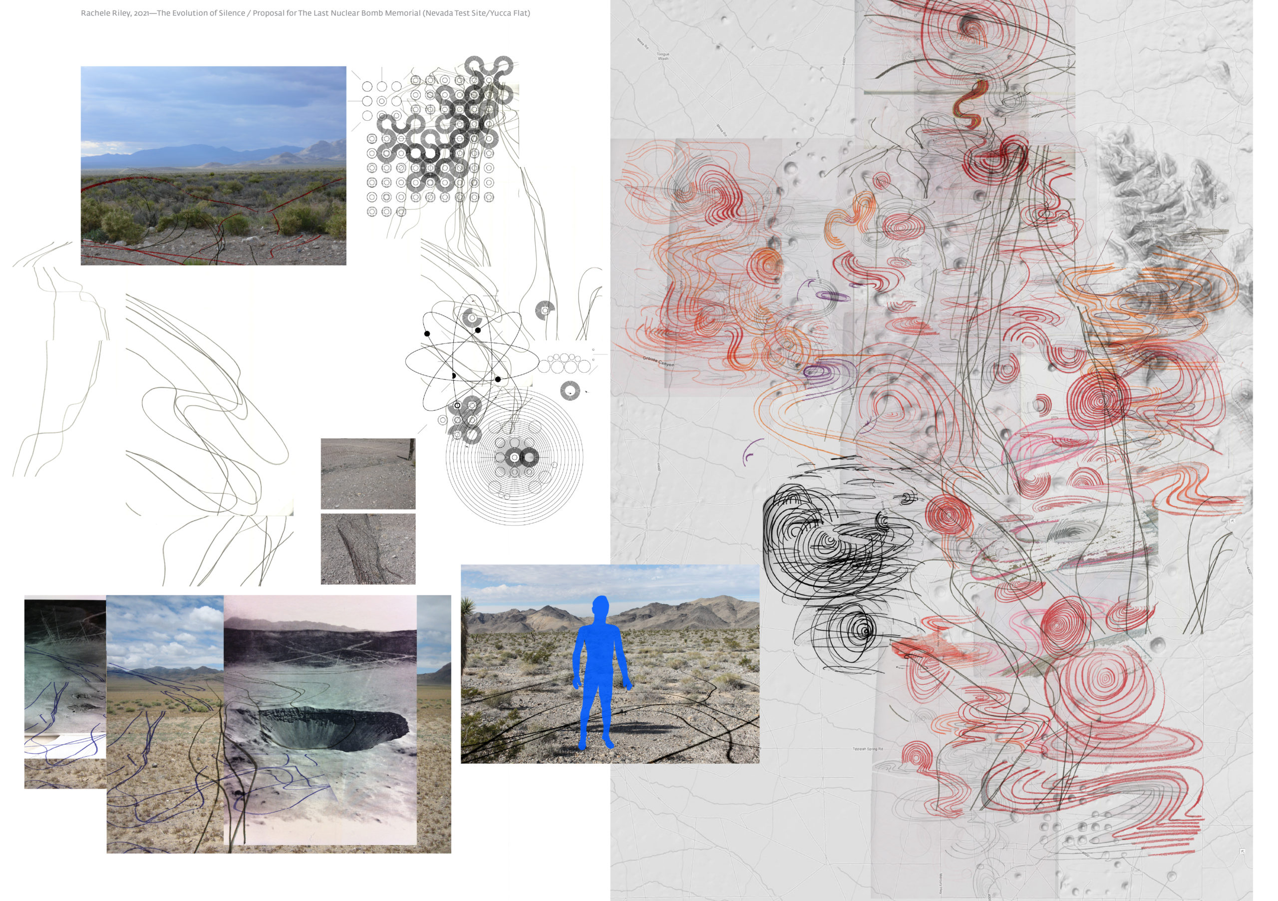
The Evolution of Silence—The Last Nuclear Bomb Memorial Proposal, 2021
Concept design drawing and proposal for an entangled and confounding path through Yucca Flat (Nevada Test Site).